Map of Tocantins, Brazil
« Back to States of Brazil
« Back to Tocantins
Ads by Google
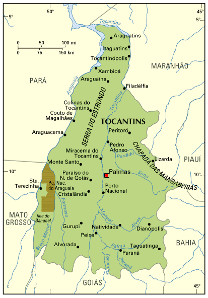 The state is cut from north to south by the river Tocantins.
Palmas, the capital, is the only city with commercial air connection, and even so very few; several large farms in the State have their own small airports.
The State of Tocantins is located in the central area of Brazil. It is one of the Brazilian States which doesn't have contact with the sea.
Tocantins is located in a transition zone among several different biomas. To the East, the arid outbacks of Brazil (called Sertão in Portuguese); to the West, the Amazon; to the South-West, the wetlands of Pantanal; to the South and South-East, the prairies of Brazil (called cerrados in Portuguese); despite making borders with Bahia (one of the most visited Brazilian States), Tocantins have nothing to do with it.
The State of Tocantins is the newest in Brazil. It was created by the new Constitution of 1988.
Formerly, the area which today is Tocantins was part of the State of Goiás.
Being located far from the large cities, Tocantins never experienced big economic growth. Goiás experienced some growth from farming and agriculture, but the lands of Tocantins are not so fertile as those of Goiás.
The main economic activity of Tocantins is agriculture, particularly soy beans. There are very few industries in the State.
The capital is Palmas; other important cities include Araguaína, Gurupi e Porto Nacional.
Back to Top