Advertising by Google
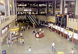
Arriving to São Paulo
Check out the map of São Paulo.
Being the richest State in Brazil, São Paulo is also the State with more connectivity to Brazil and the world.
Airports
There are three major airports in the São Paulo.
 São Paulo International Airport, best known as Cumbica Airport, official name is Airport Governor Franco Montoro. It was built in the city of Guarulhos, in the Metropolitan Area of São Paulo. This airport handles all international traffic, and all traffic from Brazilian cities other than Rio de Janeiro.
International Airport of Viracopos, in Campinas, about 100 km northwest of São Paulo. This is the largest cargo airport in Brazil. Most imports and exports shipped by air go through this airport.
Aeroporto de Congonhas. Right in the middle of the city, Congonhas operates mostly flights between Rio de Janeiro and São Paulo. The airport was recently (2004) refurbished, but still operates at full capacity. This is the busies airport in Brazil, by number of passengers (12 million per year).
Recently, the Airport of São José dos Campos has been gaining relevance, because of the businesses conducted by Embraer, which uses the airport to test aircrafts and import parts.
Roads
Map of transportations in São Paulo
Underground system
The city of São Paulo has an underground system, called "Metrô" by the paulistanos; visit the site of the Metro, and check out the map of the grid.
The trains are modern (first line opened in 1975), clean and safe. The grid, however, is not so comprehensive as it should be. The Line Green is the one which covers most tourist attractions of the city.
Back to Top