Map of the São Paulo Gay Parade
«São Paulo Gay Parade
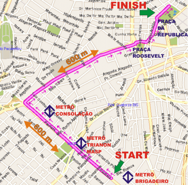
Above, the route of the São Paulo Gay Parade 2006.
The starting point is in Avenida Paulista, the financial center of São Paulo. The streets in the neighborhood of Paulista concentrate some of the finest restaurants and most expensive shops in São Paulo.
The Parade will move along Paulista as far as the corner with Rua da Consolação; from there, it will go downhill along Consolação as far as Praça Roosevelt (which was the finish point in past events), and then eventually to Praça da República.
The Parade is about 4 km long, and is walked in about 4 hours. The athletes who participate of São Silvestre, on December 31st of every year, also follow this same route.
If you are staying in a hotel near Paulista, the best way to reach the Parade is walking. All streets in the vicinity of Paulista will be taken by the crowd.
The best means of transportation to arrive in the Parade and leave it is the underground (that Brazilians call the metro). There are three stations in Paulista near the Parade area: Consolação, Trianon-Masp and Brigadeiro; as these stations will be also very crowded, maybe you find more convenient dropping off at the more distant stations of Paraíso or Clínicas.
Likewise, at the end of the Parade, there is a station called República. The metro of São Paulo maintains a detailed website, with an English version, providing several maps and other information. Visit the site: São Paulo metro underground.
Back to Top